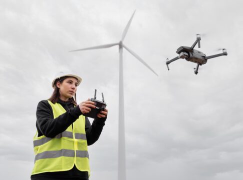
Drone-based environmental monitoring has emerged as a valuable tool for tracking climate change and supporting wildlife conservation efforts. Drones, also known as unmanned aerial vehicles (UAVs), offer unique advantages in terms of data collection, accessibility, and cost-effectiveness in environmental monitoring applications.
Here’s how drone-based environmental monitoring is being used for tracking climate change and wildlife conservation:
-
Climate change monitoring: Drones equipped with various sensors and imaging technologies can gather critical data to monitor climate change impacts. They can capture high-resolution aerial imagery, thermal images, and multispectral data to assess changes in vegetation, land cover, and water bodies. These data help scientists and researchers understand ecosystem dynamics, monitor deforestation, assess carbon stocks, and study the effects of climate change on habitats and biodiversity.
-
Habitat assessment and management: Drones enable efficient and detailed monitoring of habitats, including forests, wetlands, and coastal areas. They can provide aerial surveys, 3D mapping, and topographic data to assess habitat quality, track changes over time, and identify areas that require conservation interventions. This information supports effective habitat management and restoration efforts.
-
Wildlife surveys and monitoring: Drones have revolutionized wildlife surveys by enabling researchers to cover larger areas quickly and access remote or challenging terrains. They can capture aerial imagery, video footage, and acoustic data to monitor animal populations, track migrations, detect illegal activities such as poaching, and assess the health and behavior of wildlife. Drones also help in monitoring endangered species and their habitats, supporting conservation initiatives.
-
Marine and coastal monitoring: Drones equipped with specialized cameras and sensors can be used for monitoring marine ecosystems, coastlines, and coral reefs. They can capture aerial images and video footage, track changes in sea levels, monitor marine biodiversity, and detect signs of pollution or coral bleaching. Drones provide valuable data for coastal zone management, marine conservation, and assessing the impact of climate change on coastal areas.
-
Rapid response and disaster management: Drones play a crucial role in rapid response during natural disasters or environmental emergencies. They can be deployed quickly to assess damage, identify affected areas, and support disaster management efforts. Drones equipped with thermal imaging or gas sensors can detect fires, monitor air quality, and assist in search and rescue operations.
The benefits of drone-based environmental monitoring include cost-efficiency, scalability, and the ability to access hard-to-reach locations. However, it’s important to address challenges such as regulatory compliance, privacy concerns, data management, and the potential disturbance to wildlife during drone operations. Responsible and ethical use of drones, adherence to regulations, and collaboration among researchers, conservation organizations, and regulatory bodies are essential for maximizing the potential of drone-based environmental monitoring in tracking climate change and supporting wildlife conservation.


